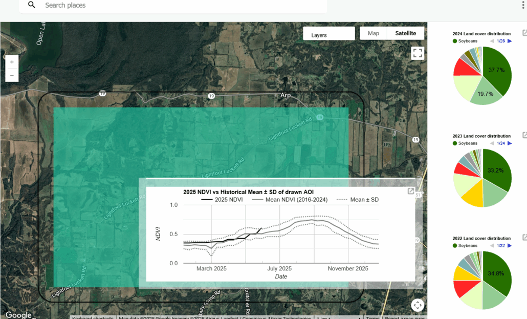
Free Digital Tool Provides Vegetation-health Monitoring
The Sentinel GreenReport Plus is a new, web-based app that provides free satellite monitoring and analysis of vegetation and crop health as a public service. The digital tool, created by researchers from the University of Kansas, integrates Google Earth Engine with high-resolution imagery from the European Space Agency’s Copernicus Sentinel-2 satellite mission to provide up-to-the-day insights into vegetation greenness, changes in land cover over time, and climate abnormalities. The tool’s creators explain, “This allows us to do more detailed monitoring of vegetation conditions—it could be vegetation in a forest community, a cropland community or on rangeland. We could create a tool that would allow access to these data easily and create an interface where people—whether educators, researchers, ranchers or cropland producers—could access the imagery easily and look at vegetation health.” In addition to revealing impacts from drought, the tool also has applications for assessing vegetation destruction from storms, wildfires, and other natural disasters.